Walking
Your selection of self guided walks
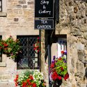
Walks with Taste
If you like to combine a great walk 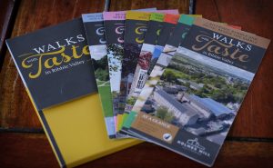 with a fantastic food experience why not choose one of our popular ‘Walks with Taste’ a selection of self guided circular walks, each based from one of Ribble Valley’s amazing hostelries, when you can return after your walk for a well-earned drink, lunch or dinner. Visit Walks with Taste to view the whole set
Walking Maps – Full Description
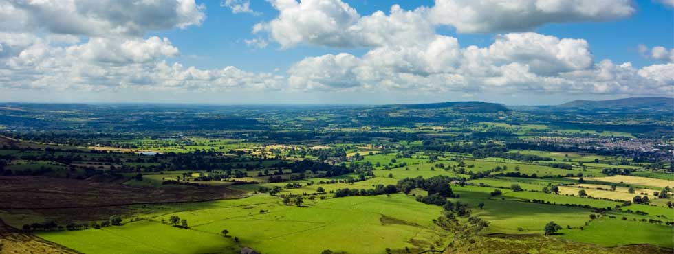
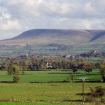 Pendle Hill rises majestically above an ancient hunting ground, once the home of wolves and wild boar, a wild and mysterious place. Beneath the hill lie pretty villages which tell a story of intrigue and witchcraft nearly 400 years old.
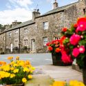
All roads lead to Chipping! And upon entering this picturesque village, you'll soon see why it has been named Winner of Britain in Bloom's Gold Medal Award & Best Village Award 2009.
On the slopes of the River Loud, you'll learn that in Medieval times you would have found no less than five water mills sighted along Chipping beck.

The earliest building at Stonyhurst was probably built in the 13th century, and added to during the 14th and 15th centuries. Around 1590, Richard Shireburn embarked on the creation of a new Elizabethan house, which wasn’t completed for a further 250 years.
Stocks reservoir was opened by HRH The Prince George on July 5th 1932. Annual rainfall here is about 1500mm (5 feet) and when full the reservoir covers an area of about 192 hectares, the equivalent of about 500 football pitches. After treatment, the water from Stocks goes mainly to the Fylde area of Lancashire.
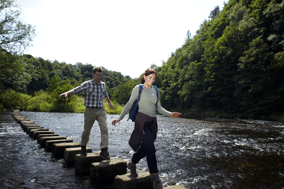
 This walk follows the Hodder Valley downstream from Slaidburn to Dunsop Bridge. After following the river as far as Newton, the route then cuts over a hillside through field paths for fine views across the Hodder Valley towards the Newton fells and the Dunsop Valley.
 Follow in the footsteps of J.R.R Tolkien and discover the landscape that inspired Tolkien’s ‘Middle Earth’. Walk through the deep wooded valleys and lazy riverside banks whose names have found their
way into his famous ‘Lord of the Rings’
trilogy. This walk starts and fi nishes at The Shireburn Arms.
 The Ribble Valley Sculpture Trail was launched in 1993. The first of its kind to be established in Lancashire, which now includes over 20 permanent works of art. The trail travels through Brungerley Park and Cross Hill Quarry, a local nature reserve managed by the Lancashire Wildlife trust, only a mile from Clitheroe town centre.
 Following the arrival of the railway, Longridge boomed. Between 1850 and 1874, four coal-powered cotton weaving mills were built along the railway line. This was accompanied by an influx of workers. Houses were built for them in the Stonebridge area, in Berry Lane and in the streets built off it. The Churches, Berry Lane School and the Co-op building were all completed by 1890. Longridge continued to grow during the first half of the 20th century.
 Bolton-by-Bowland to Slaidburn, Slaidburn to Dunsop Bridge then Dunsop Bridge to Whitewell
Leaving the beautiful church of St Peter and St Paul in Bolton-by-Bowland, we pass through peaceful moorland and the home of a 16th century rebel, to the picturesque village of Slaidburn.

Clitheroe to Chatburn then Chatburn to Bolton-by-Bowland
Starting at the site of a Civil War rebellion, this route passes through one of the oldest villages in Lancashire and takes us, via an ancient highway, past an ancient rabbit breeding ground.
 Whitewell to Chipping, Chipping to Bashall Eaves then Bashall Eaves to Clitheroe
The walk takes us from the former hunting grounds of Whitewell to the old market town of Chipping, passing a disused lime kiln and ancient forest boundaries.
 Bowland Area of Outstanding Natural Beauty has a varied and interesting past. In the early 1800’s the Park was a quarr y from which the stone was used for local buildings and major developments in Lancashire, such as The Harris Museum and the Railway
Station in Preston.
The walk starts in the hamlet of Tosside, which straddles the Lancashire/Yorkshire border on a hillside watershed.The route takes the Forestry Commission tracks through Gisburn Forest, before descending to Stocks Reservoir and dropping down to the River Hodder and Slaidburn village.
 Located in the North East corner of Lancashire and within the Forest of Bowland Area of Outstanding Natural Beauty. Gisburn Forest offers fantastic mountain biking with beautiful views. Glide easily along mellow trail by Bottoms Beck, twist and shout through Park Wood, dance with your bike down Hully Gully or grit your teeth and rush down the Bigfoot slab – everyone should find something that will make them grin.
The walk enters the approach to the Trough of Bowland before climbing above the Hodder Valley to follow a route mid way between the valley and the ridge of the Bowland fells above. The final stretch below Wolf Fell is on the edge of moorland which descends through a narrow valley and fields into the village of Chipping.
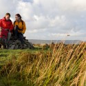 At 557 metres above sea level Pendle Hill does not quite qualify for ‘mountain’ status but nevertheless deserves to be treated with respect
and normal sensible precautions should be taken before attempting the walk. The summit of Pendle is a very exposed place and is invariably much colder and often wetter than the starting part of the walk.