


Walking
From serious rambling to Sunday strolling, this is the perfect opportunity to explore the hills and dales of Ribble Valley . Whether it’s a short walk along the banks of a river to a more strenuous climb to the top of Pendle Hill, there’s something for everyone looking for fresh air, exercise and inspiring landscapes whatever your age or ability. The countryside access right in the Forest of Bowland allows even more opportunities to walk freely across areas of mapped, open and spectacular countryside giving you some of the roughest and remote walking in the North West of England.
Walks with Taste
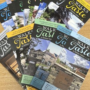
If you like to combine a great walk with a fantastic food experience why not choose one of our popular ‘Walks with Taste‘a selection of self-guided circular walks, each based on one of Ribble Valley’s amazing hostelries, when you can return after your walk for a well-earned drink, lunch or dinner. Visit Walks with taste to view the whole set.
Walking routes in the Forest of Bowland
Walks in Chipping
Chipping – Whitewell Linear Walk – This delightful linear route explores the rolling scenery of ‘Little Bowland’ and links the routes of the Number 5 and Number 11 buses. Allow three hours to complete the route – and maybe leave a little time for refreshments.
Leagram Short Circular – Roads, tracks, fields and some stiles. Can get muddy/boggy in parts. Take care on un-pavemented road sections. Expect livestock and keep dogs under close, effective control. “Walking safely” information available at www.forestofbowland.com
Walkers are advised to carry OS Explorer map OL41.
Walks in Whitewell
Radholme Circular – This is a lovely circular trail taking you over undulating hills and through the Hodder Valley in the Forest of Bowland Area of Outstanding Natural Beauty. The trail starts in Whitehall and leads you over the farmland-covered hills and down to the River Hodder before returning along the side of the valley. Some of the paths may be muddy in winter or after heavy rainfall, so come prepared with the appropriate footwear. You’re likely to encounter livestock on the way, so make sure to keep dogs on leads. less
Walks in Dunsop Bridge
River Dunsop and Black Brook Circular – Following the edge of Black Brook Wood, this walk takes you up out onto the farmland above Dunsop Bridge where, on a clear day, you have wonderful views of both the lower slopes of Beatrix Fell to the north and back down the Hodder valley to the south. The route then drops back into the Dunsop valley and follows the track back to the village.
Dunsop Bridge to Whitewell Linear Walk – This walk offers fantastic views of the Hodder valley and surrounding hills. The walk follows the River Hodder along the valley from the pretty village of Dunsop Bridge to the hamlet at Whitewell. Take in the wonderful scenery of the Hodder Valley with the surrounding fells of Totridge and Hodder Bank Fell and be rewarded at the end of the walk with refreshments at the Inn at Whitewell.
Centre of the Kingdom – This is quite a demanding 10-mile fell-walk, which requires sturdy walking boots and reliable wet weather gear, but it’s well worth the effort for the views alone. Look out for rare hen harriers and ring ouzels along the way.
Dunsop Bridge Easy Access Trail – An easy access trail which takes in the wonderful scenery of the Dunsop Valley. Take care on unpavemented road sections. Be aware of timber wagons using the road. Expect livestock and keep dogs under effective control.
Hodder Bank Fell Circular – Combining riverside and open fell, this walk offers fantastic views of the Hodder valley and surrounding hills. Starting from the village of Dunsop Bridge, the route takes in the parkland around Knowlmere Manor before heading up and over the expanse of Hodder Bank Fell then dropping back down to the valley floor via Fielding Clough and a return to the village via riverside paths and fields.
Walks in Newton
Newton Circular – This walk starts from the pretty village of Newton-in-Bowland and takes in a riverside path, parkland close to Knowlmere Manor and a suspension bridge over the River Hodder! There are lovely views from the higher ground.
Some parts of the route are especially wet and muddy, particularly the long field to the east of The Heaning at point 7.
Walks in Slaidburn
Beating the bounds 10 mile circular – This challenging 10-mile circular route follows the route of a perambulation – or ‘beating of the bounds’, exploring the south-eastern boundary of Forest of Bowland National Landscape.
Bell Skyes Hay Meadow Walk – This walk guides you through flower rich hay meadows at Bell Sykes.
Bolton by Bowland to Slaidburn Linear -The second leg of this itinerary is the most demanding of the three – but also the most rewarding. We climb steadily to the largest expanse of woodland in Lancashire, descending through the Forest past picturesque Stocks Reservoir and into the pretty village of Slaidburn.
Slaidburn to Whitewell Linear – The hike includes an 8-mile section down the Hodder Valley, through rich pastureland and villages, leading to the riverside hamlet of Whitewell.
Gisburn Forest – It features a mix of flowing singletrack, technical sections with rock gardens and roots, and tight corners. The trail loops through scenic woodlands and offers a variety of terrain, including berms, jumps, and small drops. Well-maintained and challenging, The 8 is a fun and engaging ride for those looking to improve their skills while enjoying the natural beauty of the forest.
River Dunsop and Black brook Circular – Following the edge of Black Brook Wood, this walk takes you up out onto the farmland above Dunsop Bridge where, on a clear day, you have wonderful views of both the lower slopes of Beatrix Fell to the north and back down the Hodder valley to the south. The route then drops back into the Dunsop valley and follows the track back to the village.
Tolkien Trail
Many places in the UK claim to have inspired J.R.R Tolkien’s Lord of The Rings, but none share a connection as deeply as Stonyhurst College during World War II. Whilst Tolkien’s sons attended the prestigious school, he would go on walks around Stonyhurst and Hurst Green, and was often spotted in the pub revelling with locals.
The Tolkien Trail commemorates J.R.R. Tolkien’s close connection with the Ribble Valley. It takes you through fertile farmland, fairy bridges, rushing rivers, and to the grand Stonyhurst College itself. Covering 5.5 miles, it suits beginners and beyond. You can learn more about the trail here

If you are passionate about walking then a visit to Whalley Warm and Dry on King Street in the village, must be on your ‘to do’ list whilst visiting the area. Here, the team strives to provide the best quality outdoor clothing and footwear, combined with best possible customer service, both online and in store. The team at Whalley Warm and Dry understand the importance of properly fitted, supportive footwear and its impact on comfort and the enjoyment of your walk. Customers travel from across the country to take advantage of their multi award-winning specialist boot fitting service. Ribble Valley is a paradise for visitors with dogs, with plenty of amazing walks and facilities which your dog can enjoy either with or without you as there are many dog walking services available and even a dog play barn where it can be left for the day.
The Ribble Valley Jubilee Trail
As part of the Borough’s Jubilee celebrations, Ribble Valley Mayor for 2022-23 Councillor Stuart Hirst inaugurated a new circular walking trail around the beautiful Ribble Valley and Forest of Bowland Area of Outstanding Natural Beauty.
As a keen walker, Stuart devised this new 65-mile route with seven stages – linking scenic local villages and places of interest around the Ribble Valley.
Starting in the bustling town of Whalley, the route is split into seven easily manageable sections and is designed to be walked as a challenging three-day trek, or a more relaxed 5-7 day walking tour. Along the way, the walk visits picture postcard villages like Downham and Slaidburn and also climbs to the summit of iconic Pendle Hill.
The route has been planned, reconnoitred and waymarked personally by the 2022-23 Mayor with help from Council colleagues and the support of Lancashire Footpaths Officers. It is suitable for experienced walkers who are comfortable covering 7-12 miles a day in hilly terrain, although the shorter individual sections could comfortably be completed by less experienced walkers.
As well as a fitting Jubilee tribute to her Majesty Queen Elizabeth in her Platinum Jubilee year, the route will also be developed as a permanent visitor attraction supporting the Ribble Valley’s tourism offer to attract walkers to spend more time exploring our beautiful – but often overlooked – area of rural Lancashire.
The Mayor’s inaugural walk took place in September 2022 and the route is now available to browse on these pages. Digital mapping and downloads are also available via popular walking Apps, including OutdoorActive & OS Maps.
Find out more here The Ribble Valley Jubilee Trail – Ribble Valley Borough Council
